
Biodiversity Net Gain
The suitability of habitat improvements/actions are based upon an appropriate ecological survey and inspection of the land. Design decisions are made in conjunction with locally relevant evidence, expert input and guidance, ensuring the interventions are realistic and deliverable within the project timeframe.
We use the official defra Biodiversity Metric to calculate how a change in land management will enhance the biodiversity value of a site, following this process:
- Initial desktop assessment to find ownership, location, type, size, condition and strategic significance
- Baseline using the Biodiversity Metric survey
- Environmental management options to arrive at Biodiversity Net Gain measured in Units
- Draw-up a Conservation Covenant or s.106 agreement to ensure 30-year validity
- Create a Management Plan for monitoring and reporting the project
- Establishment of biodiversity uplift Banking
- Marketed through our agency
- Recording of biodiversity sites on the Government's Biodiversity Net Gain Registry
Environmental enhancement is reported through three distinct Biodiversity Unit BU types, further divided and recorded within our registry as:
- Area - species rich grassland, scrubland or woodland
- Linear - hedge or line of trees
- Linear - watercourse
We can advise on matching you to a site that suits your requirements and location.
Local Nature Recovery Strategies (LNRS) are being drawn-up to inform national environment policy. Underpinned by the 25 Year Environment Plan (2018) and the Environment Plan 2020. The purpose of the LNRS is to restore and link up habitats so that species can thrive and agree the best places to help nature recover, plant trees and woodland, restore peatland, mitigate flood and fire risk, and create green spaces for local people to enjoy.
These developing strategies will help to inform the location and delivery of biodiversity, and will be referenced on the individual sites as they evolve.
Natural Capital elements
- Are offered subject to documentation / contract / submission.
- We also only act on a subject to contract / documentation basis when buying units / credits for our clients and do not enter into oral contracts.
- Any such verbal comments or statements made by Natural Capital Estate during the consultation process or otherwise cannot be relied upon unless such advice is provided in writing following receipt of written instructions for Natural Capital Estate to provide such advice. Any such oral comments or statements do not form part of our brokerage instructions or any transfer contracts.
- Any quotes, prices, rates or advice given by Natural Capital Estate may be subject to change by future Government reforms.
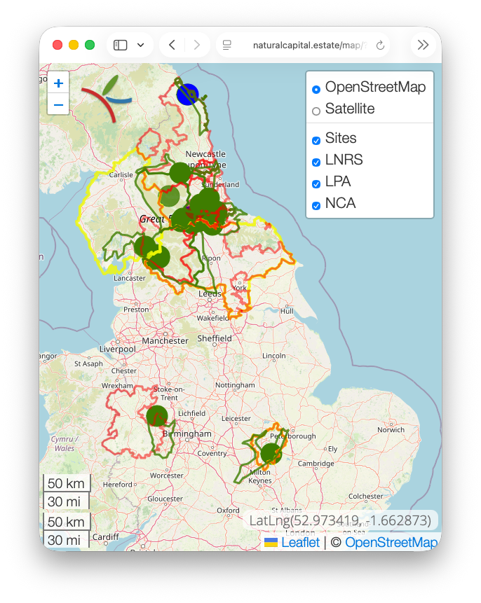
Map Controls
You can toggle the map type, sites and LPA and NCA boundary layers from the control at the top-right of the main map page.
Coming next year will be the Local Nature Recovery Strategies areas, when they're all released. The proposal is to use only these areas as the criteria for spatial weighting.

David Hall
Fellow of the Royal Geographical Society FRGS
Geographical Information Systems MSc
Natural Resource Management MSc
Scientific Illustration HND
Rural Estate Management MRAC